Wednesday, November 29, 2006

Alpine Mornings


Paper thin warmth
shatters against sharp cold
breath of October morning

Wednesday, October 18, 2006

Difference between a Crouch and Squat (and ancillary notes on the Hunker)

Difference between a Crouch and Squat

(This is not my idea. Patrick F. McManus, an outdoors comedy writer, is the one who first cleared it up for me. I read one of his books, I can't remember which, when I was 15 or 16, and learned the difference between the crouch and squat. Also, John Krakauer discussed some of the issues below, but as he doesn’t site sources or do true research either, I don’t feel bad not being more specific. Don’t get me wrong – what he writes is entertaining – but he often writes non-fiction based in crappy research, stereotypes, and fear.)

OK. This is a PG topic. (Not my typical G rating.) Why would one write about such a topic? you might ask. Well, because when you’re in the wilderness you become more deliberate in your actions. You typically pay closer attention to your surroundings, pay attention to where you place your next step, how much water you have, and so on. One of the most undesirable everyday experiences (one which, if you put it off, will sit in the back of your mind all day) is the squat.

Almost every morning most of the people I’ve backpacked with use this term: “Oh crap, I have to squat.” (HA! That’s pretty funny.) Or, in mixed company you may hear the term “Oh crap, I have to dig a cat hole.” Actually, one could hear any number of things but they all mean the same – it’s bathroom time without a bathroom. This is called “squatting.”

While the position one takes up, "squatting," may seem similar in form to a crouch, the respective functions are very different. For example, while in a crouch, people are apt to either initiate or at least participate in conversation. Often, someone in a crouch may even draw a map in the dirt, further explaining their ideas.

The squat position, however, is a very personal experience. Besides groans of pain – thigh burn and such – or relief, the most conversation you typically get from someone squatting is, “crap, can I borrow a couple squares?” The process usually starts with a solo walk, at least 200 feet from the closest water, path, and camp. I often try to find an old dead tree close to which there is soft loamy dirt. Cat holes should be at least 8” deep and wide enough to keep the resulting bio load 6” under the surface once covered. NOTE: Men, to avoid p-moisture on the back of your pants, it’s usually a good idea to shake the dew from your lily pad before squatting. I understand, although I have not witnessed it myself, that K.C likes to totally remove his pants in preparation for a squat. I personally feel coordinated enough that this seems a little unnecessary and can get you caught worse than with your pants down.

Now you know – if someone is squatting, I recommend you stay away. While very uncomfortable, once you’re done with the squat, unless you’re sick or eating a lot of fiber, you can probably put another one off until the next morning and will feel much better. Don’t put it off if you need to do it! I’ve seen people try this and it is never a good idea.

The crouch, on the other hand, or resting on haunches, can relieve tired leg muscles for a few moments. Personally, I don’t like the crouch either. I don’t mind if others crouch, but my knees are too old for the crouch. I either hunker or sit. I won’t bore you with the details on what a hunker is except that it usually involves food – trail mix, jerky, and such.

One other thought: honestly, is anyone carrying out their “litter” from a squat? I’ve read articles discussing this option, leaving the bio load but collecting the clean-up litter. Give me a break. If you’re doing this, you’re crazy. Just dig at least 8” and bury it!

Tuesday, October 10, 2006

Naturalist Basin, Uinta Mountains, Utah


Location: Naturalist Basin, Uinta Mountains, Utah
USGS Quad(s): Hayden Pk
Trip date(s): October 6th to 8th
Why go?: Spectacular scenery, access to Spread Eagle Peak, fishing
Water: All over the place
Human Traffic: Between June and September, high. During an October snow storm and freezing temperatures, nobody
Difficulty: Going all the way into the basin, following the Highline trail from either Mirror or Butterfly lakes, is a moderate up and down 7ish mile pack
GPS Coordinates: All in UTM

Introduction
(NOTE: We had a lot of fun on this trip, but this blogg does not read as such. Oh well. Maybe it’s because I’m writing it late at night.)


K.C, Ryan, and I decided to go on this trip as a somewhat last minute thing. We weren’t even sure if we’d go, watching the weather closely. As we hiked to the basin, it rained, sleeted, and snowed. We were fairly fluid as to our ultimate destination for the day but were aiming for Jordan Lake. We made it, barely. I learned a number of things on this trip (see Things I Learned below).

Things I Learned
It was COLD. As I like to say (and my grandfather before me), it was colder than a mother-in-law’s kiss. I had been watching the weather reports closely and did not think the temperature would go below freezing at night and would climb to the 50s or 60s during the day. I was WRONG. Also, while I thought I knew my limits, I think I met them, or at least one, on this trip. While in the wilderness, especially during a stressful trip, we learn to recognize our limits and understand how to center on healthy instincts. Below is a list of things I learned:

1. Importance of conscientious gear maintenance. By 6 pm it had started to snow and the wind was blowing. I left my stove out – did not put it away. That could have been a huge mistake. It was under 4 inches of snow by the next morning, encased in ice. Luckily, both K.C and Ryan had packed stoves as well. I also left some food wrappers out, near where we eat. That, besides just being sloppy and lazy, could have lured bear into camp.

2. Also, while covering the backpacks with a tarp, I noticed some of K.C’s gear lying near his pack. While I put some away and zipped the pack, I left some out. Why? I was tired, wet, and cold and had had enough. I just wanted to get into my sleeping bag to warm up. Luckily, all I left out was his cooking pot. But what if it had been his stove as well?

3. My father used to tell me that if I could just stay dry, I’d stay warm. While hiking in, it started to snow and rain but for some reason, I did not use my poncho. As a result, I was soaked by the time we made camp. This created a lot of discomfort and thus I felt a strong desire to be dry and warm – causing me to make so many silly mistakes.

4. 2 pairs of gloves. I only packed one pair. This was a problem because after the 1st day, my gloves were soaked. This meant that the next morning, when it was below 20 degrees, I only had pockets for my hands. I’m going to invest in either a second pair of gloves or some Gore-Tex gloves, or something. We’ll see how rich I’m feeling.

Trip Log
I’m waiting for K.C to e-mail the log to me – he kept it this time.

Notes
Our camp site was great, probably one of the first times we picked such a great spot. It was on the East side of the lake, near a tight copse of trees and right below a small ridge, offering shelter from the wind (GPS coordinates: 12 T 0517217, 4505828)

Thursday, October 05, 2006

Who is he talking about?

The Packers

So, I’ve started documenting some of my backpack trips and realized I’ve not introduced the players. I haven’t asked for their permission, so, except in the case of Ryan and K.C and Kali, I’m going to change names, to avoid whatever would happen if someone’s real name is used. These are just short bios of each packer and how we’re (they and I are) connected.

It is interesting to note, and important to remember, that neither myself or the people I backpack with are hardcore outdoorsmen/women. We have typical jobs and have typical lives – as typical as anything. Motivations – who knows? I cannot guess or infer motivations. Actions, though, show a passion for the outdoors from all of them.

(So, I’m writing this while sitting in a meeting – we’ll see what I say)

Me (Brian): 30 something. Born in Utah, served 2 year church mission in Okayama Japan. Smokin’ hot wife. 3 kids – 2 girls and 1 boy. Earned master’s in Instructional Technology and live for weekends.

K.C: 20 something. My younger brother. Working on fire science BA. Who knows where he’s working right now, but he’s single.

Ryan: 30 (almost 40) something. My sister’s husband. Sells houses and such. Has 4 kids, ranging from 15 to 1 year old.

Kali: 7, looking forward to 8. My oldest kid, one of two daughters. Smart, fun loving, and is totally at home in the outdoors. Especially likes taking pictures and fishing.

Seyi: K.C’s best friend, as far as I can tell. Every time we stop to eat in rural Utah, the girls hit on him and the men ask him where he plays ball – it’s so much fun to give him a hard time about that! He’s attending school also, earning some sort of BA.

Erik: my 30 something cousin. Has gone on one trip with us. Seems to like the outdoors but not to keen on backpacking with myself and the other misfits – not sure why . . .

Gregg: my childhood friend. He’s gone on one trip with us. Would like to go on more but work and other responsibilities keep him on a short leash (read between the lines, men)

Bryss: childhood friend. He’s gone on one trip with us. Writes the outdoor section of a Utah newspaper. The one trip he went on with us was while I was training for a marathon, running about 32 miles a week, and he still hiked me into the ground. Needless to say, I have not tried very hard to invite him on any other trips

Dug: my older brother. I’m not sure how old he is, but if he’s not 40 then he’s really close. He likes the outdoors but is working multiple jobs. And that, my friends, is a freakin’ shame!

Mike: my father-in-law. He went on the Yellowstone/Shoshone lake trip. Very comfortable in the outdoors but doesn’t feel like he can keep up with us on a regular backpack. He’s either using that as an excuse to not have to share a tent with me or he did not watch how slow Ryan is with a pack on his back

Sarah: my wife’s sister (my sister-in-law). I think she went on one trip with us because she had just been dumped by a boy. Now she’s married and lives back East. Too bad for her.

Michael: I used to work with him at NACT. This guy has a nose for direction and is a very accomplished woodsman. He hunts pretty much anything you can kill. 
10-5-06: pre-trip log
OK. My smokin’ hot wife said to me a few weeks ago, “you haven’t been backpacking for a while. You should go.” Who cares if she just wants to get rid of me – I’m not missing that opportunity! So, we’re leaving tonight, late (Ryan has to work until 9). We like to leave late, the night before a trip is set to officially start, and sleep at or near the trail head. That way, we don’t have to wake up at 4 am to get an early start. Also, waking up at 4 am is a waste because Ryan won’t start packing until 4:30 am.

We’re going into the Uinta Mountains again – the Naturalist Basin area (just east of Mirror Lake, along the highline trail – elevation around 9,500 feet). It’s a high traffic area, but since it’s October and has been raining/snowing for almost 3 weeks now, we’re pretty confident that all we’ll see is a few stray muzzle loader hunters. We’ll be in a wilderness area also, so the hunters will either be on foot or horse – we won’t have to worry about 4-wheelers (dude, I hate those things).

Gear list for fall, alpine trip:
Clothing:
-Fleece jacket
-Water proof wind breaker
-Fleece gloves
-1 pair pants – the ones that zip off as shorts and have big pockets
-1 pair sturdy hiking boots
-2 pair of wool socks
-2 short sleeved shirts
-1 long sleeved shirt
-Extra underwear
-Wool beanie
-Poncho (one of the $2 Wal-Mart specials)

Gear:
-Backpack
-Day pack
-Cold weather sleeping bag
-Sleeping pad
-Stove
-1 canister fuel
-Matches
-1 mug
-1 spoon
-Head lamp
-3 extra AAA batteries
-2 32 oz. H2O bottles
-Water purifier
-Pocket knife
-GPS
-4 extra AA batteries
-Compass
-1st aid kit – I’ll blogg later about what is in my 1st aid kit
-Lip balm
-VIP (in Ziploc bag)
-Small plastic trowel
-Small paperback book
-USGS Topo map
-Pen

Food (for 2 nights, 3 days)
-Dinner (x2)
--2 mountain home camp meals (I like spaghetti the most)
--2 snickers bars
--Apple cider
-Lunch (x3)
--2 baggies full of wheat thin crackers
--9 string cheeses
--2 baggies of M&M delight (M&Ms, sunflower seeds, almonds)
--2 baggies peppered jerky
-Breakfast (x2)
--4 Quaker oat breakfast bars (apple is my favorite)
--Hot chocolate
--Multi-vitamin

Misc
-Gas money

Plan
Watch the Office at 7:30 PM. Leave my house at 8ish. Leave Ryan’s house at 9:30ish. I’ll be surprised if we get out of there before 10pm. Drive to Kamas and sleep on the road.

Day 1: pack into Naturalist basin, choose a lake we like, and setup camp
Day 2: wander
Day 3: Go home

Notes
I’ll post the results of the trip later next week

Monday, October 02, 2006

Shoshone Lake, Yellowstone, Idaho


Shoshone Lake

Location: Shoshone Lake, Yellowstone Park, Wyoming
USGS Quad(s):
Trip dates: Late June
Why go?: Spectacular wilderness, wildlife, geyser basin, fishing, adventure
Water: um, you're in a canoe
Human traffic: Moderated by Yellowstone park
Difficulty: With perfect weather and no bugs, this would be an easy trip. Including those variables, it can be a highly stressful trip
GPS Coordinates of interest: I've lost them, but the geyser basin is next to the north-west corner of Shoshone Lake
Important details: (1) since this is a very popular trip for scout, church, and other such groups Yellowstone park limits traffic. You must send in an application, specifying the number in your party, intended campsites, and camp dates. It is important to do this as soon as the opening date as possible as you might not get your trip reservation. (2) Early summer means bugs and Yellowstone backcountry means A LOT of mosquitoes. (3) You need to bring rope so you can string your backpack up the tree stands they've built (to minimize bear attraction)

Introduction

The route for Shoshone lake trip is within Yellowstone park back country. The only way into Shoshone Lake is either by boat and paddle or foot. We decided to canoe into the area. The only lake entrance is at the boat ramp on Lewis Lake, south of Shoshone Lake. Motors are allowed on Lewis Lake but not Shoshone Lake. Luckily, my father-in-law has a small outboard motor and wanted to come. He used that to motor all 3 canoes (the motor was on our canoe in front and the other 2 were tied on by rope – a water train) across Lewis lake and then north along the west bank. Just before the mouth of Lewis River we stashed the motor in the bushes, about 100 yards off the bank, and noted the spot with GPS.

There were 7 people in the party: Michael and I in his canoe; K.C and Seyi in Ted's canoe; Ryan, Alec, and Doug in a borrowed canoe – the biggest of the 3.

Day 1

The trip across Lewis Lake is slightly dangerous, as high winds often pick up, especially in the afternoons. Thus, it is important to head straight west as you launch so you cross the lake a fairly narrow point and then progress north along the western bank.

Lewis River flows south (from Shoshone Lake into Lewis Lake). It is a slow paddle until about a mile below Shoshone Lake where the river moves too quickly for paddling. At this point, we had to wade in the river and push/pull the canoes the rest of the way to Shoshone Lake. Note: there are bears in Yellowstone. We made the mistake of allowing those (slackers) who did not push/pull the canoes to walk individually along the side of the river. That was our first mistake but luckily nothing happened. The brush was thick and if one strayed even a little from the river they may have become disoriented. We had a couple novice outdoors men with us and could have either lost them to bears or the wilderness.

Just kidding about the slacker comment above. Actually, the people who did most of the walking were Doug, Ryan, and his son Alec. Ryan's sandal broke early on the push and started falling back so Seyi took his place. Alec, at the time, was too small to wade the river safely. I'm not sure why Doug didn't push, except that K.C seemed to be doing fine. Michael, my father-in-law, pushed half way and I pushed the other.

We stopped for lunch at the mouth of the river as it drains out of Shoshone Lake. We had already spotted a number of bald eagles and saw more as we ate. This memory remains in my head as one of my favorite of the trip. The sun was warm and as I sat, trying to dry out and eat, I felt very calm and soaked up the scene.

Once at Shoshone Lake, there are a number of camp sites. As mentioned already, you have to reserve the campsites. We camped about 2 miles west of the mouth of Lewis River the first night.

Soon after locating our first camp is when we realized the mosquitoes problem. We encountered swarms and swarms of mosquitoes. It was almost impossible to breath and eat without swarms of mosquitoes flying into our eyes, mouths, and ears. Luckily, we all had bug repellant. This saved us from many bites, I'm sure. It did not save us from a thick swarm of mosquitoes hovering around any exposed skin; ANY exposed skin (toilet trips were expedited). If I ever return on this trip, I'm going to pack mosquitoes net, at least to drape over my face. This was Alec's first trip, and I think the bugs made him miserable. I have heard from others that the bugs are not nearly as bad later in the summer, but I will not chance it.

On this trip you must plan for rain, hail, and snow. Even during the summer. It rained every afternoon we were there. We actually welcomed a good hard rain as the mosquitoes would retreat while it rained (but only if it was raining very hard).

Day 2

The second day, we canoed to the far north-west corner of the Shoshone lake. To cross the lake, you should either cross at the narrow stretch in the middle of the lake, or follow the shore line. This is vitally important to remember. People have died not following this advice. High winds frequently pick up, especially in the afternoons. We never crossed the lake in the afternoon, but if we did I would have insisted that we follow the shore instead of expose ourselves to a mile or more of paddling across open water.

Once we made it to the north-west corner, we hauled the canoes onto shore and turned them over. That day’s destination was a 3 mile pack off the lake. We ate lunch and hunkered down through a quick drizzle, and then started into the hike. What a great hike!

First, the trail winds through a small geyser basin which is only accessible by foot. We had it all to ourselves. I was inches away from small geysers and mud holes. The path is clearly marked and I recommend you not stray. Likely burn injuries would be highly dangerous in this environment, so far from help. At one point, steaming water crossed the path and was scalding to the touch.

The trail winds North and West, following a slight draw and stream as it flows down the hillside. There is a river crossing about 2 miles up the trail. There are two narrow trees on which you should cross as the stream is at least 15 yards wide.

The camp site sits on top of a knoll in pine and quaky grove. To the west is a ridge marking the continental divide. I had originally planned to walk up to the top so I could straddle the divide. Rain threatened though, and we didn’t want to risk lightning on the ridge.

Instead we decided to have a contest to see who could stand the longest without swatting at mosquitoes. When I say we, it really means K.C, Ryan, and I. I won, but had only just applied bug spray. We have video footage of hundreds of mosquitoes on K.C’s back, neck, and face with K.C squealing like a little girl. It’s hilarious.

Day 3

The next morning we hiked back to the canoes and started back across the lake. We tried to get out early as we did not want to try a lake crossing after noon. It turns out that we made the right decision.

As we crossed, the canoes became somewhat separated, more than usual. This was not a problem as we all had the UTM coordinates for our next campsite (on the south side of the lake again). We crossed the lake a couple hundred yards from the western shore without incident. Michael and I decided to take a stroll on the south west corner of the lake as we both though we saw a large mammal moving through the trees. The ground was wet – more marsh than anything else. We didn’t see anything but water.

Once we were back on the lake, the wind started to pick up a little. Ryan, Doug, and Alec waited for us while K.C and Seyi paddled ahead. As we paddled along the south shore, right at the narrow neck separating the west and east side of the lake, someone said, “what’s that sound?” It sounded like someone was shaking a heavy plastic tarp just to the north of us. As we turned, we could see a storm coming. The narrow of the lake is about 1 mile wide. We watched as the storm began crossing the lake with, what we thought was rain, dumping from the dark clouds. I started looking for my poncho, getting more and more excited the longer it took to find. (I’m told I started yelling, “where’s my poncho, where’s my poncho!” although I doubt I yelled it.)

It was only a short moment before the storm hit us. We were next to the shore, but it was a vertical climb of more than 20’ before firm ground so we grabbed what foliage was available and rode out the storm. It was not rain though, that hit us. It was wind driven hail, the size of jaw breakers. We were all exhilarated. I’m not the only one who hooped and hollered like we were on a roller coaster. And then, as quickly as it started, it was over.

We found K.C and Seyi not far ahead, reporting a similar experience. Luckily they too were close to shore when it hit.

Than afternoon at camp, we watched another storm crash through. I sat in the tent, feeling the ground shake with each clap of thunder. I have yet to experience anything of such force yet in my life. Latter that evening, as the storm moved south and east, a ranger paddled by. He informed us that trees in one of the camps just to the west of us had been blown over by the wind. That evening was the most pleasant of the trip as the bugs seemed to have given up after such a storm.

Day 4

This is the morning that sits in my memory, the one to which I compare all other mornings in the wilderness. We woke to thick fog silently rolling off the lake, seeping into everything. It was beautiful. As we paddled onto the lake, we quickly lost sight of camp in the fog and had to stay bundled up until well into the morning when the mist finally started to give way to rising sun.

The trip back down Lewis River was exciting. We decided to float the whole way. We could see strips of paint and fiberglass on some of the bigger rocks but we managed to navigate without major incident.

It was an easy walk to Michael’s motor once at the mouth of Lewis Lake and then smooth sailing back to the cars after that. Luckily I was on the front of the lead canoe as the other two canoes broke into a water fight.

Summary

Everyone who went on this trip desperately wants to do it again, only later in the summer when there are less bugs. I will take my pole the next time and catch some of those monster lake trout that supposedly live under the surface.

Southwest Desert, Zions Park, Utah


Location: Southwest corner of Zion’s National Park
USGS Quad(s):
Trip Dates: January 2005
Why go?: Spectacular desert scenery, petrified forest, solitude (if you go during the right season). Actually, if you have to ask, then you shouldn't go. Stay home so the rest of us can enjoy it
Water: Plentiful during winter and spring.
Human Traffic: we went during January and didn’t see anyone else
Difficulty: Moderately difficult navigation

Introduction

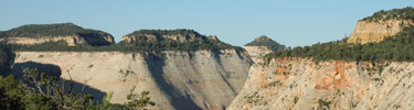
We wanted to make a winter trip and decided to try this area of Zion’s national park. Again, our bad luck held out and it was extremely wet while we were there – we probably saw 6 inches of snow fall. It was extremely muddy as well.

Inbound

The hike into the southwest desert follows a stream bed north and east in a deep cut valley. A few miles into the gorge it splits, one part heading west and the other continuing north east. It is important to have someone in your group who can read a map and make correct decision. Unfortunately, our skills failed us and we continued in the east fork, different from our trip plan. Luckily, being stupid but happy, we eventually found some high and relatively dry ground on which to camp.

Water was an issue as it was chocked with fine silt. After a few dozen pumps, my purified was totally clogged with the silt. We tried to fill a container to let the silt settle to the bottom. We let it sit all night but the silt was so fine, it was still floating in the water. NOTE: when someone backpacks and complains about silt in the water, please do not immediately say “didn’t you let it sit for while, duh?” That really bugs.

Fortunately we found a clear running stream a little to the west of camp. The water was a little green, but tasted fine (once we grew used to the funny taste).

Day 2

In that area, there is really not a big attraction. No ruins, unique rock formations, lakes, or anything. On the quad though, there was a mine marked. We decided after breakfast to make for that landmark which was a good 5 miles away, most of it off trail.

We struck out west, moving up a ridge through an area littered with petrified wood – whole logs were petrified. After a couple of miles we had to strike north, leaving the trail. The going was slow, but beautiful. To the North we could see gathering clouds, and as we circled a small peak to our right, we caught glimpses of the tree sisters to the east. To the west and south was a wide open view of a valley sloping down towards St. George and I-15 (too far away to be seen during the day).

We descended to a stream formed gorge running east and west and followed that to the mine. It was interesting – a shaft running straight into the ground with old mining equipment lying around. We ate lunch there, looking around at the surroundings and soaking in the solitude before setting back off to camp.

Our trip back to camp provided more excitement than the trip to the mine. It started to snow, a lot, so we decided to deviate from the path earlier, and almost immediately struck south. We had to cross the peak we kept on our right earlier in the day. It was steep and snow was accumulating, but it ended up being easier than we initially thought it would. Once on the other side (south/east side), we were up against the huge rock formations towering above us. The soft sand along the base had become so soft it was impossible to cross or walk on and reminded me of some fantasy novel waste land. We were able to find our small clear running stream and followed it back to camp.

That evening I struck out on my own for a little walk, looking for human and animal tracks, following our initial path further east. By this time the snow had stopped, and it was all silent around me. That land is full of peace and contentment. Ryan was worried about me and I found him pacing around camp when I returned. It is never a good idea to wander alone in the wilderness – especially when it is getting dark and visibility is low due to snow and clouds.

So, that night, after eating and wandering a bit more, we decided to call it a night. The sky started clearing and the temperature started dropping. I struck out north to dig a cat whole. It was amazing that we could see a glow in the sky to the south west (just over my left shoulder) from the city of St. George.

For whatever reason, I was very disoriented after I finished my cat hole. I started walking the same direction I started, away from camp. Luckily, I had been walking slightly downhill from camp and noticed that I was still going downhill not long after I started walking. It is easy to get lost in the wilderness.

That night, the clouds rolled back in and it snowed a little more. The temperature climbed, and the snow turned to rain some time in the night. I got hot in my bag and a little closterphobic. Ryan woke up, trying to unzip the door where there was no door, moaning, “I’m gonna barf, I’m gonna barf!” That would have been awful as he was right next to my head, zipping and unzipping a small window in the tent. I told him the door was at our feet. All he did was stuck his head out and the fresh air seemed to calm down his stomach. We have been very fortunate as a small case of the turkey trots is the worst sickness any of us have had yet in the wilderness.

Outbound

The trip out was tricky. We decided to bypass the gorge we followed up and instead struck almost directly west. We went too far though, and had to backtrack a few miles before descending back into the gorge. Ryan found a trail into the gorge, luckily. It probably saved us hours of walking. We ate lunch under some outcropped rocks as it had started raining again.

When we finally made it back to the van, there was a not stuck to the windshield from the park rangers. They wanted us to call them when we made it out. Apparently, when we filled out the back country permit, there was a mistake and it said we were going to leave the day before. I guess they had called my wife (the emergency contact) and told her that we were lost. Jamie told them we probably were, but that we were not planning to leave until the following day. I guess they were about to mount a search party to come and find us.

We stopped in Cedar City for pizza on the way home. What a great trip.

Davis Gulch, Glen Canyon, Utah

Route Name, Location: Davis Gulch, Glen Canyon, Utah
USGS Quad(s):
Trip date(s): Feb and April 2004
Why go? Solitude, Anasazi ruins, beautiful scenery
H20: Plenty
Human Traffic: Almost none
Difficulty: Except for the descent into and ascent out of the gulch, the hike itself is not difficult. Navigation can be tricky as there is not a trail

Description
So, we went to Davis Gulch the first time because it was cold and wet (feet of snow) in northern Utah but we wanted to get out. I found information on the gulch in a book, Hiking Utah, by David Hall. It is located right next to Lake Powell in the Glen Canyon recreation area, within boundaries of a wilderness area.

The first time we went, in Feb. 2004, it was COLD! While there was not snow at our level, we could see it topping the surrounding red buttes, and our water froze each night, even with our water bottles inside the tent next to our sleeping bags. We base camped above the gulch, worried about threatening rain, and were caught in some high winds which made the cold even colder (colder than a mother-in-law’s kiss).

We found out, on the second trip (April 2004), that there are a few places in the gulch on which you can setup a tent and sleep. This is a lot better than camping above the gulch as water is usually running down the gulch and the wind is not nearly as bad. We came the second time because we were so enchanted with the place the first time. I’m sure we’ll go again. These camp spots are well above possible flood levels, nestled close to the cliff wall in the shade.

Special Features
This hike has no trail head, no markers, or anything. As a result, you probably won’t run into anyone while you’re there. I’m not sure, but since there are a number of Anasazi ruins inside the gulch (and one that we found above), that the feds are not quick to have a lot of traffic through the area. You have to hike above the gulch for some time as the only descent is near the lake.

Below are some coordinates to things we found while wandering around, above, and within the gulch. If you go, please do not mess with any artifacts – no touching, taking, defacing, and so on (all coordinates are in UTM). Also, please do not depend on these coordinates to keep yourself out of danger or anything – not my fault if you get lost or hurt! But you can thank me if you make it out safe, charged from seeing things that could be 1,000 years old. Also, there is a lot more to see than what I have documented here. I could not get a good GPS fix once the canyon walls started closing in.

Mill stone: 12 S 0502785, 4127 125 
Rock art: 12 S 0504210, 4128073
Arch: 12 S 0505479, 4129270
Ruin: 12 S 0503756, 4127438
Good place to begin descent into gulch: 12 S 0503840, 4128130

Trip Log
I don’t have a good log for this trip.

Notes
Even though further up the canyon there are not many ruins, I strongly recommend you wander all the way up. There are huge cathedrals cut into the sand stone, cool places to sit, and in general it’s different than anywhere else in the world (or at least my little world). Keep your eyes open for rock art and even steps carved into the stone, ascending out of the gulch in what I would consider a course bent on suicide.

Once you get to the top of the gulch, it gets extremely narrow and appears impassible. We climbed a long way into that narrow crack, as far as we could go without ropes. We had to do some swimming, but it was worth it. I would not recommend going into this narrow point unless you are extremely adventurous and a little stupid. It looks passable, but again, we did not have ropes and therefore had to turn around and go back down the gulch (which was the plan in the first place).

White Pine Lake, Utah, Logan Canyon


Location: White Pine Lake, Logan Canyon, Utah
USGS Quad(s):
Trip Dates: Spring and Fall
Why go?: Easy access, easy trail, easy fishing, and beautiful scenery
Water: It’s a lake
Human Traffic: Late spring through fall = a lot of hikers
Difficulty: Easy 2 ½, difficult ½ (drop into bowl where lake is and hiking out of bowl)

Introduction

I’ve backpacked to White Pine Lake 3 times for overnight trips – once with K.C, Ryan, Greg, and Seyi in the spring of 2004; once with K.C, Ryan, Bryce and his little brother Devon, Sara (sister-in-law) (fall of 2004); once with just my daughter, Kali (late summer 2005). Growing up nearby, I made the trip many times as a day hike.

It’s only 3 miles from the trail head at Tony Grove lake to White Pine Lake. The trip into the lake is relatively easy as the path slowly winds up a gentle climb for about 2 ½ miles and then drops into a bowl where White Pine Lake sits. This is why I choose it as Kali’s first backpack trip. That is also why I made the other 2 trips – we were short on time and wanted to go somewhere easy.

During the summer, you can count on at least two or three other groups to be there and almost always a scout group is there.

Spring 2004

Not long after my father kicked off, K.C and I decided we needed to take a trip. Ryan said he would come, but it was the day after we wanted to start so we left without him, planning to meet him early Saturday morning at the lake.

There was heavy cloud cover as we started the hike and it started raining before we were half way to the lake. It was a steady rain but luckily didn’t turn into a real downpour with lightning until just as we had our tents up. To avoid other people, we camped about 1/8th mile north/east of the lake.

While Seyi at jerky in the tent he shared with K.C, K.C and I cooked dinner under a tree. I think we both got soaked. I dove into my tent to eat my dehydrated spaghetti, apple cider, and snickers bar. In my memory, this is probably the best meal I’ve had in the wilderness. There was lightning and thunder like I’ve never seen. I was cold, so I removed my wet clothes, snuggled into my sleeping bag, and ate. It was awesome.

Ryan was scheduled to hike in that morning. I woke up early to walk towards the trail head so he wouldn’t have to walk the whole way by himself. I should have stayed in my tent and waited for the lightning to stop, but I was a little worried about him so I yelled to K.C that I was leaving and started back up, out of the bowl.

When I was maybe 200 yards from our tents, the storm intensified, with lightning all over and the rain changing into very heavy snow flakes. So, I’ve talked to and read recommendations on how to avoid getting struck by lightning. I was really scared that I had made a mistake, but didn’t want to walk out in the open, so I found a medium sized tree and hunkered under it, eating some breakfast bars as lightning flashed and thunder crashed all around me.

After a while the lightning moved on, leaving only a heavy downpour. Again, I should have gone back to the tent and waited out the storm, but I felt bad for poor Ryan, slugging through the weather by himself, so I pushed on. If you knew Ryan, you would ask me at this point, “what were you thinking. You know he’s probably still in bed.” I should have known – I made it all the way to the trail head and his car wasn’t even there yet. So, I climbed into my car, turned on the heater, and fell asleep.

After Ryan finally made it, we started hiking to the lake. We ran into a bunch of people coming out, all of whom told us we were crazy. The rain had stopped, but it was cold and wet. About half way in, we met K.C and Seyi. K.C had a huge backpack on, not his own. Someone trying to hike out had asked K.C to carry his pack for him as it was too heavy! That is by far the strangest thing that has happened to us since we started getting out like this. Ryan and I told them we meet back at the tents. K.C carried that pack all the way out, literally following the admonition to walk with a main two miles if he asks you to walk one. (Matthew 5:41)

(NOTE: at the time of Christ, Roman soldiers could legally force a Jewish male to carry the soldier’s backpack for 1 mile. So, when Christ told his followers to “go twain,” he was literally telling them to carry the soldier’s pack two mile, twice as far as they were required by law.)

The rest of that trip is a blur. I remember the 4 of us wandering into the forest north east of the lake and talking Seyi into chewing pine “gum.” I totally recommend that if you’ve never had the chance. It’s awesome. The trick is, you have to get the biggest and most fresh drop of sap possible. Just put it in your mouth and start to chew. Mmm, mmm.

Fall 2004

This trip is memorable for 2 reasons: first, we hiked in a night under a full moon; second, in two days I climbed 3 peaks in the area, all nearly 10,000 feet (Naomi Peak – 9,979 feet, Mount Magag – 9,750 feet, and Mount Gog – 9,714 feet) and 1,700 feet above White Pine Lake.

The hike in was great. Fall nights under a harvest moon = peace. We only lost the trail once and quickly found it again.

The 3 peaks adventure was something I’m not sure I will do again. It was great to be on the peaks, but I was wasted, especially the first second day in which we hiked up Mount Naomi and Magog. The terrain is extremely steep.

Summer 2005

Kali and I made this trip after school had started in 2005. I took a Friday off from work. We left early Friday morning and drove up to Logan, eating lunch at McDonalds. Before the trip, kali and I had pored over maps – I was trying to get her excited about the trip. She was 6 at the time.

My pack was pretty heavy, but watching her enjoy the backcountry like that easily made it worth the extra weight. My wife and I take our kids camping often, each of them since they were only a few months old. So Kali was no stranger to camping. But the opportunity to hike with just dad, and the sense of freedom the backcountry affords, I think made a magical combination in her young mind.

I didn’t think 3 miles would be too far, but the last mile took us a long time on the way into the lake. Once we were there, Kali helped setup the tent. We immediately went down to the lake to catch some fish. Fortunately we didn’t catch any, but we had a lot of fun trying. That night, Kali and I ate dinner in the dark and then crawled into the tent. I had not yet bought Kali a good sleeping bag, so she was in my 0 rated bag and I was in the lighter one. She slept like a log and didn’t even mind when I woke up and had to leave for a few minutes to go “potty.”

We fished most of the morning, again lucky to not catch anything. While I took down the tent and packed, Kali wandered around, always within eye-sight of me. I had her wear a whistle around her neck, along with the compass. She loved the compass, and stopped almost every 5 minutes to check which direction she was headed.

Kali still talks about that trip. We didn’t go last summer because I had started a new job and didn’t have enough vacation. But I am taking her this summer (2007). I’m not sure where but I’m going to make the hike shorter so we have more time to spend fishing and walking around together. We might take Caleb – he’s only 4. If Caleb comes, I’ll have to make K.C come with to act as sherpa.

Middle Basin, Uinta Mountains

Location: Middle Basin, Uinta Mountains, Utah
USGS Quad(s):
Trip date(s): June 2002
Why go?: Solitude, beautiful scenery, good fishing
Water: All over the place
Human Traffic: Moderate
Difficulty: Getting into the basin is a matter of following the trail. If you do it in one shot it could be considered difficult because there is a good climb at the end of a 5 or 6 (or more, who knows?) mile hike. Once you’re in the basin there are a number of exploration possibilities which require some moderate orienteering (or GPS) skills – at least someone who can remember which way camp is.

Introduction
We went up in mid-June and it was cold at night. There were still a few snow drifts, but just enough to keep a fish chilled until it was time to cook. The fishing was fast for the guy who brought his fly rod and decent for the rest.

Special Features
Mountain goats. Good fishing (pretty brook fish). Solitude. Quiet.

Trip Log
Day one: Starting at Christmas meadows campground on north east slope of Uinta Mountains, we hiked almost 8 miles into middle basin, camping near “lake desolation,” just east of Ryder Lake. (Lake Desolation was named by the group as the topo did not indicate a name. We were really tired when we stopped.) The hike was beautiful the whole way but long and tiring, especially for old fat guys, and young and skinny guys. Once we made camp, it cooled off enough that all we wanted to do was eat dinner and then go to bed. It was cold that first night, with ice covering shallow water in the morning.
Day two: I woke up early, eating breakfast and then pumping some water. We noticed big cat tracks (maybe mountain lion – who knows? We’re not the best with scat and tracks. It appeared as if the claws were retracted, possibly indicating a cat. The paw was about 4” in diameter.) near the water, between “lake desolation” and Ryder lake. As most of the group fished in Ryder lake, I went with Greg just below the base of Hayden peak (on the east side). We climbed above the tree line, paying attention to scat and tracks.
Once above the tree line there was a lot of cat scat. We glimpsed some mountain goats, moving white specs near the summit of Hayden Peak. Just below the peak they disappeared into some scrub bush. We sat, quietly, waiting for either the goats or a cat to appear, but grew restless after a while so we descended back to Ryder lake. Most of the group fished the afternoon away. I wandered to the southern side of the basin, hoping to see some wildlife but was disappointed.
Day 3: Greg and Eric left, being expected home by that evening (sissies). From what I understand, Eric fell backward into a huge mud puddle on the way down. Greg laughed a lot and Eric didn’t. That seems like a hilarious scene to me.
Ryan and K.C and I stayed for one more day, exploring much of the basin. We walked the breadth of the basin from north to south, K.C and Ryan fishing in the small lakes near the south side (and were skunked) while I read a book. That night we ate dinner, watched the stars for a cold moment, and then went to bed. As this was my first backpack since I was 16, I froze that night, not being prepared for the cold nights. I had carried only a light sleeping bag with me on this trip and had hoped that if I squeezed into Ryan and K.C’s tent I’d be okay – that wasn’t the case. Besides the cold, I had to endure Ryan’s stench.
Day 4: We ate breakfast and hiked out. Honestly, I was not happy to leave. This had been probably the most relaxing 4 days I’d had since being a young kid and would spur annual or bi-annual (and sometimes tri-annual) backpacks in successive years. Our families met us at Mirror Lake for tinfoil dinner. What a great way to end a backpack!

Notes
As yet, neither I nor any of my fellow backpackers had invested in a GPS unit (in fact, I still haven’t. I use an old one I “inherited” from my dad when he kicked-off). Therefore, I have no exact GPS coordinates. Middle basin is pretty open though and it is, in my opinion, paradise on earth. I have nothing but pleasant memories of that place.


useful backcountry links

Honestly, I have yet to find really useful outdoor sites. Here are some of the links I depend on while preparing for backcountry trips. Preparation is the key. Once, I spent 4 days in Southern Utah in a place called Dark Canyon. It took us almost 24 hours to find water so we ended up base camping near the water hole. I also forgot to mark my topo with documented NA ruins. We still had a great time, but our travel was limited and we didn’t see the main goal for traveling down there – Indian ruins.

Weather
Topo peek
Fishing
Gear List

It’s really more about the types of links I have above – weather, location details (topo), fishing, and gear lists. What else do you need to know?

Introduction

 So, I’m not anxious to share locations, trails, coordinates, and such about my back country destinations. But, I’m confident there will only be a few people who lay eyes on this blogg. Also, if you found this blogg and you really have the drive to go to these destinations, I’m willing to share. Just don’t mess them up (i.e. remove your trash, dig deep cat holes, don’t build fires, and so on).

I’ll try to stay politically neutral. All I will say is: wilderness is extremely important and 4-wheelers, logging, and mining are an abomination. There is so much room to ride 4-wheelers in NA that what little wilderness we have should be protected. All that oil that is supposedly in Southern Utah that some people think should be mined is a farce. If some of those towns down there, craving money from mines, would change their message as a pristine wilderness stop, they would do a lot better. Just look at Moab.

One other thing – let it burn! I don’t see why we keep wasting all the money to extinguish forest fires when we could just let it burn, like it would if we weren’t around to interfere. If we did that, all of the old forests with piles of deadwood would be replaced by new forest. It’s just piling up, waiting to burn, and burning all the hotter with the deadwood around. If we let it burn, the fires wouldn’t be nearly as bad and it would save us a lot of tax money.

There you go. Now you know how I feel about wilderness. The rest of these bloggs should be about wilderness journeys with some important GPS coordinates. I tend to walk slow, look around, and fish once-in-a-while.