Showing posts with label cold. Show all posts

Tuesday, October 10, 2006

Naturalist Basin, Uinta Mountains, Utah


Location: Naturalist Basin, Uinta Mountains, Utah
USGS Quad(s): Hayden Pk
Trip date(s): October 6th to 8th
Why go?: Spectacular scenery, access to Spread Eagle Peak, fishing
Water: All over the place
Human Traffic: Between June and September, high. During an October snow storm and freezing temperatures, nobody
Difficulty: Going all the way into the basin, following the Highline trail from either Mirror or Butterfly lakes, is a moderate up and down 7ish mile pack
GPS Coordinates: All in UTM

Introduction
(NOTE: We had a lot of fun on this trip, but this blogg does not read as such. Oh well. Maybe it’s because I’m writing it late at night.)


K.C, Ryan, and I decided to go on this trip as a somewhat last minute thing. We weren’t even sure if we’d go, watching the weather closely. As we hiked to the basin, it rained, sleeted, and snowed. We were fairly fluid as to our ultimate destination for the day but were aiming for Jordan Lake. We made it, barely. I learned a number of things on this trip (see Things I Learned below).

Things I Learned
It was COLD. As I like to say (and my grandfather before me), it was colder than a mother-in-law’s kiss. I had been watching the weather reports closely and did not think the temperature would go below freezing at night and would climb to the 50s or 60s during the day. I was WRONG. Also, while I thought I knew my limits, I think I met them, or at least one, on this trip. While in the wilderness, especially during a stressful trip, we learn to recognize our limits and understand how to center on healthy instincts. Below is a list of things I learned:

1. Importance of conscientious gear maintenance. By 6 pm it had started to snow and the wind was blowing. I left my stove out – did not put it away. That could have been a huge mistake. It was under 4 inches of snow by the next morning, encased in ice. Luckily, both K.C and Ryan had packed stoves as well. I also left some food wrappers out, near where we eat. That, besides just being sloppy and lazy, could have lured bear into camp.

2. Also, while covering the backpacks with a tarp, I noticed some of K.C’s gear lying near his pack. While I put some away and zipped the pack, I left some out. Why? I was tired, wet, and cold and had had enough. I just wanted to get into my sleeping bag to warm up. Luckily, all I left out was his cooking pot. But what if it had been his stove as well?

3. My father used to tell me that if I could just stay dry, I’d stay warm. While hiking in, it started to snow and rain but for some reason, I did not use my poncho. As a result, I was soaked by the time we made camp. This created a lot of discomfort and thus I felt a strong desire to be dry and warm – causing me to make so many silly mistakes.

4. 2 pairs of gloves. I only packed one pair. This was a problem because after the 1st day, my gloves were soaked. This meant that the next morning, when it was below 20 degrees, I only had pockets for my hands. I’m going to invest in either a second pair of gloves or some Gore-Tex gloves, or something. We’ll see how rich I’m feeling.

Trip Log
I’m waiting for K.C to e-mail the log to me – he kept it this time.

Notes
Our camp site was great, probably one of the first times we picked such a great spot. It was on the East side of the lake, near a tight copse of trees and right below a small ridge, offering shelter from the wind (GPS coordinates: 12 T 0517217, 4505828)

Monday, October 02, 2006

Southwest Desert, Zions Park, Utah


Location: Southwest corner of Zion’s National Park
USGS Quad(s):
Trip Dates: January 2005
Why go?: Spectacular desert scenery, petrified forest, solitude (if you go during the right season). Actually, if you have to ask, then you shouldn't go. Stay home so the rest of us can enjoy it
Water: Plentiful during winter and spring.
Human Traffic: we went during January and didn’t see anyone else
Difficulty: Moderately difficult navigation

Introduction

We wanted to make a winter trip and decided to try this area of Zion’s national park. Again, our bad luck held out and it was extremely wet while we were there – we probably saw 6 inches of snow fall. It was extremely muddy as well.

Inbound

The hike into the southwest desert follows a stream bed north and east in a deep cut valley. A few miles into the gorge it splits, one part heading west and the other continuing north east. It is important to have someone in your group who can read a map and make correct decision. Unfortunately, our skills failed us and we continued in the east fork, different from our trip plan. Luckily, being stupid but happy, we eventually found some high and relatively dry ground on which to camp.

Water was an issue as it was chocked with fine silt. After a few dozen pumps, my purified was totally clogged with the silt. We tried to fill a container to let the silt settle to the bottom. We let it sit all night but the silt was so fine, it was still floating in the water. NOTE: when someone backpacks and complains about silt in the water, please do not immediately say “didn’t you let it sit for while, duh?” That really bugs.

Fortunately we found a clear running stream a little to the west of camp. The water was a little green, but tasted fine (once we grew used to the funny taste).

Day 2

In that area, there is really not a big attraction. No ruins, unique rock formations, lakes, or anything. On the quad though, there was a mine marked. We decided after breakfast to make for that landmark which was a good 5 miles away, most of it off trail.

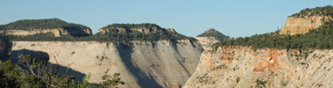
We struck out west, moving up a ridge through an area littered with petrified wood – whole logs were petrified. After a couple of miles we had to strike north, leaving the trail. The going was slow, but beautiful. To the North we could see gathering clouds, and as we circled a small peak to our right, we caught glimpses of the tree sisters to the east. To the west and south was a wide open view of a valley sloping down towards St. George and I-15 (too far away to be seen during the day).

We descended to a stream formed gorge running east and west and followed that to the mine. It was interesting – a shaft running straight into the ground with old mining equipment lying around. We ate lunch there, looking around at the surroundings and soaking in the solitude before setting back off to camp.

Our trip back to camp provided more excitement than the trip to the mine. It started to snow, a lot, so we decided to deviate from the path earlier, and almost immediately struck south. We had to cross the peak we kept on our right earlier in the day. It was steep and snow was accumulating, but it ended up being easier than we initially thought it would. Once on the other side (south/east side), we were up against the huge rock formations towering above us. The soft sand along the base had become so soft it was impossible to cross or walk on and reminded me of some fantasy novel waste land. We were able to find our small clear running stream and followed it back to camp.

That evening I struck out on my own for a little walk, looking for human and animal tracks, following our initial path further east. By this time the snow had stopped, and it was all silent around me. That land is full of peace and contentment. Ryan was worried about me and I found him pacing around camp when I returned. It is never a good idea to wander alone in the wilderness – especially when it is getting dark and visibility is low due to snow and clouds.

So, that night, after eating and wandering a bit more, we decided to call it a night. The sky started clearing and the temperature started dropping. I struck out north to dig a cat whole. It was amazing that we could see a glow in the sky to the south west (just over my left shoulder) from the city of St. George.

For whatever reason, I was very disoriented after I finished my cat hole. I started walking the same direction I started, away from camp. Luckily, I had been walking slightly downhill from camp and noticed that I was still going downhill not long after I started walking. It is easy to get lost in the wilderness.

That night, the clouds rolled back in and it snowed a little more. The temperature climbed, and the snow turned to rain some time in the night. I got hot in my bag and a little closterphobic. Ryan woke up, trying to unzip the door where there was no door, moaning, “I’m gonna barf, I’m gonna barf!” That would have been awful as he was right next to my head, zipping and unzipping a small window in the tent. I told him the door was at our feet. All he did was stuck his head out and the fresh air seemed to calm down his stomach. We have been very fortunate as a small case of the turkey trots is the worst sickness any of us have had yet in the wilderness.

Outbound

The trip out was tricky. We decided to bypass the gorge we followed up and instead struck almost directly west. We went too far though, and had to backtrack a few miles before descending back into the gorge. Ryan found a trail into the gorge, luckily. It probably saved us hours of walking. We ate lunch under some outcropped rocks as it had started raining again.

When we finally made it back to the van, there was a not stuck to the windshield from the park rangers. They wanted us to call them when we made it out. Apparently, when we filled out the back country permit, there was a mistake and it said we were going to leave the day before. I guess they had called my wife (the emergency contact) and told her that we were lost. Jamie told them we probably were, but that we were not planning to leave until the following day. I guess they were about to mount a search party to come and find us.

We stopped in Cedar City for pizza on the way home. What a great trip.

Middle Basin, Uinta Mountains

Location: Middle Basin, Uinta Mountains, Utah
USGS Quad(s):
Trip date(s): June 2002
Why go?: Solitude, beautiful scenery, good fishing
Water: All over the place
Human Traffic: Moderate
Difficulty: Getting into the basin is a matter of following the trail. If you do it in one shot it could be considered difficult because there is a good climb at the end of a 5 or 6 (or more, who knows?) mile hike. Once you’re in the basin there are a number of exploration possibilities which require some moderate orienteering (or GPS) skills – at least someone who can remember which way camp is.

Introduction
We went up in mid-June and it was cold at night. There were still a few snow drifts, but just enough to keep a fish chilled until it was time to cook. The fishing was fast for the guy who brought his fly rod and decent for the rest.

Special Features
Mountain goats. Good fishing (pretty brook fish). Solitude. Quiet.

Trip Log
Day one: Starting at Christmas meadows campground on north east slope of Uinta Mountains, we hiked almost 8 miles into middle basin, camping near “lake desolation,” just east of Ryder Lake. (Lake Desolation was named by the group as the topo did not indicate a name. We were really tired when we stopped.) The hike was beautiful the whole way but long and tiring, especially for old fat guys, and young and skinny guys. Once we made camp, it cooled off enough that all we wanted to do was eat dinner and then go to bed. It was cold that first night, with ice covering shallow water in the morning.
Day two: I woke up early, eating breakfast and then pumping some water. We noticed big cat tracks (maybe mountain lion – who knows? We’re not the best with scat and tracks. It appeared as if the claws were retracted, possibly indicating a cat. The paw was about 4” in diameter.) near the water, between “lake desolation” and Ryder lake. As most of the group fished in Ryder lake, I went with Greg just below the base of Hayden peak (on the east side). We climbed above the tree line, paying attention to scat and tracks.
Once above the tree line there was a lot of cat scat. We glimpsed some mountain goats, moving white specs near the summit of Hayden Peak. Just below the peak they disappeared into some scrub bush. We sat, quietly, waiting for either the goats or a cat to appear, but grew restless after a while so we descended back to Ryder lake. Most of the group fished the afternoon away. I wandered to the southern side of the basin, hoping to see some wildlife but was disappointed.
Day 3: Greg and Eric left, being expected home by that evening (sissies). From what I understand, Eric fell backward into a huge mud puddle on the way down. Greg laughed a lot and Eric didn’t. That seems like a hilarious scene to me.
Ryan and K.C and I stayed for one more day, exploring much of the basin. We walked the breadth of the basin from north to south, K.C and Ryan fishing in the small lakes near the south side (and were skunked) while I read a book. That night we ate dinner, watched the stars for a cold moment, and then went to bed. As this was my first backpack since I was 16, I froze that night, not being prepared for the cold nights. I had carried only a light sleeping bag with me on this trip and had hoped that if I squeezed into Ryan and K.C’s tent I’d be okay – that wasn’t the case. Besides the cold, I had to endure Ryan’s stench.
Day 4: We ate breakfast and hiked out. Honestly, I was not happy to leave. This had been probably the most relaxing 4 days I’d had since being a young kid and would spur annual or bi-annual (and sometimes tri-annual) backpacks in successive years. Our families met us at Mirror Lake for tinfoil dinner. What a great way to end a backpack!

Notes
As yet, neither I nor any of my fellow backpackers had invested in a GPS unit (in fact, I still haven’t. I use an old one I “inherited” from my dad when he kicked-off). Therefore, I have no exact GPS coordinates. Middle basin is pretty open though and it is, in my opinion, paradise on earth. I have nothing but pleasant memories of that place.