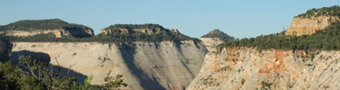
Location: Southwest corner of
USGS Quad(s):
Trip Dates: January 2005
Why go?: Spectacular desert scenery, petrified forest, solitude (if you go during the right season). Actually, if you have to ask, then you shouldn't go. Stay home so the rest of us can enjoy it
Water: Plentiful during winter and spring.
Human Traffic: we went during January and didn’t see anyone else
Difficulty: Moderately difficult navigation
Introduction
We wanted to make a winter trip and decided to try this area of
Inbound
The hike into the southwest desert follows a stream bed north and east in a deep cut valley. A few miles into the gorge it splits, one part heading west and the other continuing north east. It is important to have someone in your group who can read a map and make correct decision. Unfortunately, our skills failed us and we continued in the east fork, different from our trip plan. Luckily, being stupid but happy, we eventually found some high and relatively dry ground on which to camp.
Water was an issue as it was chocked with fine silt. After a few dozen pumps, my purified was totally clogged with the silt. We tried to fill a container to let the silt settle to the bottom. We let it sit all night but the silt was so fine, it was still floating in the water. NOTE: when someone backpacks and complains about silt in the water, please do not immediately say “didn’t you let it sit for while, duh?” That really bugs.
Fortunately we found a clear running stream a little to the west of camp. The water was a little green, but tasted fine (once we grew used to the funny taste).
Day 2
In that area, there is really not a big attraction. No ruins, unique rock formations, lakes, or anything. On the quad though, there was a mine marked. We decided after breakfast to make for that landmark which was a good 5 miles away, most of it off trail.
We struck out west, moving up a ridge through an area littered with petrified wood – whole logs were petrified. After a couple of miles we had to strike north, leaving the trail. The going was slow, but beautiful. To the North we could see gathering clouds, and as we circled a small peak to our right, we caught glimpses of the tree sisters to the east. To the west and south was a wide open view of a valley sloping down towards St. George and I-15 (too far away to be seen during the day).
We descended to a stream formed gorge running east and west and followed that to the mine. It was interesting – a shaft running straight into the ground with old mining equipment lying around. We ate lunch there, looking around at the surroundings and soaking in the solitude before setting back off to camp.
Our trip back to camp provided more excitement than the trip to the mine. It started to snow, a lot, so we decided to deviate from the path earlier, and almost immediately struck south. We had to cross the peak we kept on our right earlier in the day. It was steep and snow was accumulating, but it ended up being easier than we initially thought it would. Once on the other side (south/east side), we were up against the huge rock formations towering above us. The soft sand along the base had become so soft it was impossible to cross or walk on and reminded me of some fantasy novel waste land. We were able to find our small clear running stream and followed it back to camp.
That evening I struck out on my own for a little walk, looking for human and animal tracks, following our initial path further east. By this time the snow had stopped, and it was all silent around me. That land is full of peace and contentment. Ryan was worried about me and I found him pacing around camp when I returned. It is never a good idea to wander alone in the wilderness – especially when it is getting dark and visibility is low due to snow and clouds.
So, that night, after eating and wandering a bit more, we decided to call it a night. The sky started clearing and the temperature started dropping. I struck out north to dig a cat whole. It was amazing that we could see a glow in the sky to the south west (just over my left shoulder) from the city of
For whatever reason, I was very disoriented after I finished my cat hole. I started walking the same direction I started, away from camp. Luckily, I had been walking slightly downhill from camp and noticed that I was still going downhill not long after I started walking. It is easy to get lost in the wilderness.
That night, the clouds rolled back in and it snowed a little more. The temperature climbed, and the snow turned to rain some time in the night. I got hot in my bag and a little closterphobic. Ryan woke up, trying to unzip the door where there was no door, moaning, “I’m gonna barf, I’m gonna barf!” That would have been awful as he was right next to my head, zipping and unzipping a small window in the tent. I told him the door was at our feet. All he did was stuck his head out and the fresh air seemed to calm down his stomach. We have been very fortunate as a small case of the turkey trots is the worst sickness any of us have had yet in the wilderness.
Outbound
The trip out was tricky. We decided to bypass the gorge we followed up and instead struck almost directly west. We went too far though, and had to backtrack a few miles before descending back into the gorge. Ryan found a trail into the gorge, luckily. It probably saved us hours of walking. We ate lunch under some outcropped rocks as it had started raining again.
When we finally made it back to the van, there was a not stuck to the windshield from the park rangers. They wanted us to call them when we made it out. Apparently, when we filled out the back country permit, there was a mistake and it said we were going to leave the day before. I guess they had called my wife (the emergency contact) and told her that we were lost. Jamie told them we probably were, but that we were not planning to leave until the following day. I guess they were about to mount a search party to come and find us.
We stopped in
